
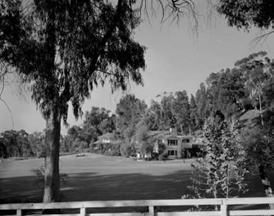
In March 2003, the California Department of Parks and Recreation (DPR or Department) adopted the Historic Landscape Management Plan (HLMP) as the guiding document for implementation of historic preservation and site planning efforts at Will Rogers State Historic Park (WRSHP) in Los Angeles County. Will Rogers State Historic Park is the site of the ranch and home of one of the most significant Americans of the early twentieth century—Will Rogers. As such, the Will Rogers Ranch is listed on the National Register of Historic Places.
The State Park Commission adopted the General Plan for WRSHP Park in March 1992. The General Plan directed the department to preserve, interpret, and make accessible the Will Rogers Ranch, its associated collections, historic structures, and overall historic landscape for the public’s enjoyment and appreciation. It also declared that the primary purpose of the park was to serve as a memorial to this internationally significant American, and to perpetuate the uses, values, and “sense of place” that he created at his Santa Monica Mountains ranch home.
The Historic Landscape Management Plan therefore provides the latest scholarship and updated planning direction for the preservation of significant cultural and natural features, operational uses, and continued public access at WRSHP. This HLMP is the result of several years of intensive research, study, and public input. The resulting plan provides DPR management with a proactive guide to support the Department’s Mission, its internal and legal resource management directives, and its declared purpose for Will Rogers SHP.
Final Historic Landscape Management Plan.pdf
Maps referenced from the above documents:
Period Map-1925-29.pdf (757KB)
Period Map-1930-35.pdf (759KB)
Period Map-1952.pdf (555 KB)
Period Map-2001.pdf (1,376KB)
Existing Conditions Primary Historic Map.pdf (183 KB)
Conservation Plan-Management Area Key Map.pdf (573 KB)
Master Site Plan.pdf (642 KB)
Circulation Plan Map.pdf (861 KB)
Conservation Plan - Area1.pdf (775 KB)
Conservation Plan - Area2.pdf (714 KB)
Conservation Plan - Area3.pdf (782 KB)
Conservation Plan - Area4.pdf (713 KB)
Conservation Plan - Area5.pdf (760 KB)
Conservation Plan - Area6.pdf (807 KB)
Conservation Plan - Area7.pdf (684 KB)
Conservation Plan - Area8.pdf (643 KB)
Conservation Plan - Area9.pdf (547 KB)
Conservation Plan - Area10.pdf (444 KB)
Historic Fences and Walls.pdf (1,846 KB)
Natural Area Vegetation Survey.pdf
Native Vegetation survey Table1.pdf (675 KB)
Native Vegetation survey Table2.pdf (685 KB)
Fire Management.pdf
To download Adobe Acrobat Reader, click here