
DPR Southern Divison Underwater Parks-TBA2
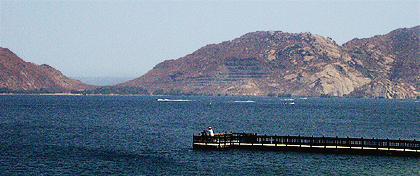
 Julia Pfeiffer Burns State Underwater Park
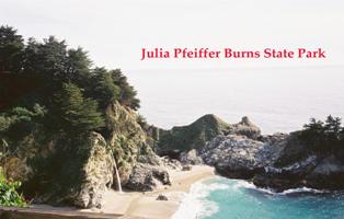
Julia Pfeiffer Burns State Underwater Park runs approximately 2.5 miles along the Big Sur coast from Partington Creek in the north to Anderson Canyon in the south. Included within the Marine Managed area is the McWay wash-rock. Just south of the underwater park is the famous waterfall that empties the water from Anderson Creek out off the rugged cliff into the waters of the Pacific. Predominantly recognized for the Big Sur forest running to rugged sea cliffs of the park, the underwater park is accessible only at the northern end near the historic Partington Landing.
Archaeological data from 1922 to 1956 indicates that there are 5 prehistoric sites in the park, including shell middens. There are 3 sea vessels that are reported to be lost in the underwater park.
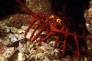
Marine Artifacts of Note in Park:
This underwater park is one of the best, kept secrets in California State Parks. Although recognized as one of the most exciting and pristine underwater environments park personnel are more likely to direct the visitor to the impressive redwoods and exotic waterfall. The remote location of the park in both historic and modern times lends itself to the lack of understanding about the maritime heritage of the park.
 Refugio State Park
Refugio State Park is a natural estero that opens into a verdant valley. Located just north of El Capitan and approximately 15 miles north of Santa Barbara, the area is bounded by the coastal hills that run to the sea and end as coastal bluffs. Both Highway 1 and the Southern Pacific Railroad hug the coastline in this area, arbitrarily delineating the coast from inland. The in-silted estero provides a flat alluvial glade between bluffs opening on to a broad sand beach.
Archaeological data from 1946 to 1952 indicates that there are 3 prehistoric sites in the park, including a settlement. There are 8 sea vessels that are reported to be lost in the underwater park.
Marine Artifacts of Note in Park:
When the property for the park was acquired by DPR they designated the offshore area, that stretches approximately 2.5 miles along the east-west running coastline, as underwater park in 1996.
There are no artifacts on display in the park that relate to the area’s maritime heritage. However, the local diving community does maintain an informative double-sided interpretive panel near the eastern bluff, close to the beach that details the underwater topography of the MMA and highlights the variety of marine life that potentially can be seen underwater.
In addition to the offshore prehistoric finds, local recreational scuba diver, Mike Martini reports that he has seen a cannon barrel offshore near the eastern reef in 12-14 ft of water. However, the cannon has not been re-found since Mr. Martini first discovered it. This may be due, in part, to the seasonal offshore/onshore flow of sand. It is possible that the cannon is from time to time covered and uncovered making rediscovery serendipitous.
 Crystal Cove State Park
Crystal Cove State Park runs along the scenic beach coast between the Southern California beach resorts, Newport Beach and Laguna. Although the park controls only a narrow strip of land west of Pacific Coast Highway 1, the submerged acreage of the park extends from the property edge of Cameo Shores south to the northern side of Abalone Point. Encompassed in the park are Pelican Point, Reef Point and an area known as Rocky Bight. Nestled at the water’s edge is the historic hamlet of Crystal Cove beach cottages. Bluffs edge the park’s beaches and the majority of park property runs inland up the slopes of the surrounding hills at the southern end of the park.
Archaeological data from 1926 to 1956 indicates that there are 30 prehistoric sites in the park, including settlements, shell middens and rock shelters. There are 6 sea vessels that are reported to be lost in the underwater park.
Marine Artifacts of Note in Park:
In the 1960s divers found the wreck of a 1947 Corsair aircraft in Crystal Cove waters. The aircraft was out of El Toro when its engine failed off Dana Point. There were no casualties. The airplane wreckage has not been re-found since that time. Saltwater corrosion on the metal parts and a 30-year hiatus between searching for the craft may explain divers inability to relocate the site.
In 2002 park personnel secured an historic anchor that had previously been recovered from the mouth of Newport Harbor channel during past dredging activities. The anchor is a large, admiralty type with folding stock. Although the artifact’s history is unclear, it is thought to have been used to anchor a Newport Harbor channel buoy marker and may have originally been associated with a grounded schooner from the first quarter of the 20th century. The anchor has now been placed in the park waters for divers to explore and enjoy.
At least one other historic anchor is located within the park as lawn art among the historic beach cottages of Crystal Cove. This anchor is smaller, older and shows signs of having been submerged in saltwater for an extended period of time. The style of the anchor, with its keyed stock and hawse ring, dates to the first half of the 19th century.
 Doheny State Beach
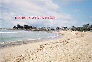
Doheny State Beach straddles the mouth of San Juan Creek running southeast from Del Obispos Street. Highway 1 and the AT& SF Railroad line border the north side of the park. Famous for the local surfing conditions it is rare to see the waters without surfers.
Archaeological data from 1948 to 1954 indicates that there is one prehistoric site in the park of shell midden. There are 4 sea vessels that are reported to be lost in the underwater park.
Marine Artifacts of Note in Park:
DPR acquired the beach in 1968 and over the next three decades supplemented the original parcel. In 1970 the area off shore was designated a Marine Managed Area. The focus of the park is on the natural marine resources. There are no maritime artifacts on display although nearby at Dana Point the replica brig, Pilgrim, has a highly evolved maritime heritage educational program that is nationally recognized. Visit Doheny State Beach.
 Lake Perris State Recreational Area
After traveling over 400 miles along the California Aquaduct, the waters of Northern California empty into San Bernardino’s Lake Perris, a manmade recreational reservoir. The lake includes the centrally located Alessandro Island and numerous beach and camping areas, as well as a waterfowl, hunting zone along the lake’s southeastern banks.
Known Prehistoric Sites: 73
Types: occupation sites and processing sites
Known Shipwrecks: 0
Reported Vessel Losses: 0
Date Range: N/A
Marine Artifacts of Note in Park:
Although there are no maritime artifacts associated with the lake, recreational scuba divers have erected an underwater jungle-jim of pipes and cages to dive around and through.
Visit Lake Perris State Recreational Area.
 Cardiff and San Elijo State Beaches
Cardiff and San Elijo State Beaches are two separate state parks ashore. The underwater park offshore is a contiguous strip. Onshore at the northern end of the parks, the high bluff bound the long run of sandy beach famous for surfing. The bluffs gradually slope down to the estero and lagoon of San Elijo at the southern end of the parks.
Archaeological data from 1928 to 1951 indicates that there is 22 prehistoric sites in the park, including shell midden. There is one know shipwreck and 3 sea vessels that are reported to be lost in the underwater park.
Marine Artifacts of Note in Park:
Although no maritime artifacts are on display in either park, several artifacts have washed up on the beach or been recovered offshore by divers. In 1947 a beachcomber discovered a cannon ball buried in the surf zone. No specific location is recorded.
In 1991 after a winter storm part of a wooden ships hull was found stranded on the beach. The second futtock of one of the ship’s frames, along with fragmentary ceiling planks and an interior wale are visible in the pictures of the piece (Kuhn 1991). The final deposition of the hull fragment is unknown. Reports in the local newspapers reveal that at least one if not more hull fragments have regularly washed up on San Elijo and Solano Beaches. The hull fragment that most recently washed ashore onto Solano Beach in the mid-1990s was removed by DPR personnel and taken to a location in San Diego. Both the smaller fragment of 1991 and the larger hull section of the mid-1990s are part of 19th or early 20th century wooden hulls. The framing, planking and fastening patterns are reminiscent of north coast lumber schooners.
Over the years rumor has waxed and waned in regard to the presence of the shipwreckTrinadad off the beaches at Cardiff and San Elijo. TheTrinadad belonged to the Spanish explorer Francisco de Ulloa, sent to explore the Californias by Cortez in the early 1500s. No evidence of the shipwreck has ever been discovered but from time to time groups apply for permits to search the Marine Managed Area off Cardiff and San Elijo for this famous expeditionary ship (Moriarity 1970).
Offshore divers located a small stone bowl similar to the ones discovered at Refugio (Ellis 1997). Since the 1950s divers have recovered metates, net weights as well stone mortars from the sandy seafloor directly off the beaches in San Diego county (Tuthill et al 1954, Woodward 1984).

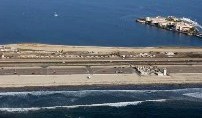
Silver Strand State Beach
Silver Strand State Beach features extensive beaches on both the Pacific Ocean and San Diego Bay. Combined with the area’s mild climate, the beaches make Silver Strand one of the state’s finest recreation destinations. Anglers can fish for perch, corbina, grunion and yellow-fin croaker.
In 1936, the California Department of Parks and Recreation purchased 32 acres at the north end of the bayside from the U.S. Army. The U.S. Navy took over the bayside parcels during the later summer of 1941 and, during the war, dredged the original parcels of land almost out of existence, creating a larger parcel of above-water property in the tidal flats. The ocean-side 40-foot strip remained in state ownership and, in fact, grew as bay dredging for naval purposes dumped millions of tons of sand onto the beaches on both sides of the highway, creating an extensive "new" beach.
During World War Two, the State Parks Commission acquired additional property from the Spreckles and the Coronado Development Company (successor of the Coronado Beach Company.) In 1955, the State Lands Commission gave the California Department of Parks and Recreation all of the "artificially accreted lands and tide and submerged lands," creating a large addition to Silver Strand State Beach. Visit Silver Strand State Beach.
Known Prehistoric Sites:
Types:
Known Shipwrecks: 0
Reported Vessel Losses: 0
Date Range:
Marine Artifacts of Note in Park: TBA