Anderson Marsh State Historic Park Test Brochure
Four habitats — oak woodlands, freshwater marsh, riparian, and grasslands— with the wildlife they attract, sustained local native people for millennia.
Anderson Marsh State Historic Park occupies the southeast corner of the oldest freshwater lake on the North American continent.
The largest freshwater lake located entirely within California’s boundaries, Clear Lake has been known to yield lake sediment samples as much as a half-million years old.
From late spring to early winter, the marsh is lush and green, its open waters edged by tules and other aquatic growth. Bird watching is rewarding here. Besides fishing, the lake—full of non-native crappie, bluegill, black bass, and catfish—also offers boating, camping, picnicking, and swimming.
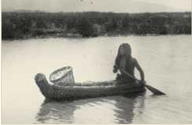 NATIVE CALIFORNIA INDANS
The area of Anderson Marsh is imprinted with the rich cultural heritage of its native peoples.
Southeastern Pomo — The park and adjoining area comprise the ancestral territory of the Koi Nation of Northern California, a Southeastern Pomo tribe. The ancestral Koi were among the first humans to colonize California, arriving at least 14,000 years ago. The Koi, remarkably wealthy and prosperous traders, controlled two local sources of obsidian that were widely traded throughout Northern California. Other resources included magnesite, a beautiful adornment stone used to make highly valued stone beads. Although they did not live at the coast, the Koi also manufactured shell beads and controlled their distribution in Northern California. Clear Lake basin, with its unique fishery, provided abundant protein-rich resources for both trade and sustenance. The Koi permitted non-Pomo people access to the lake and its resources.
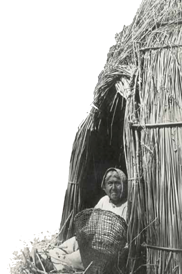 When non-Indian immigrants first arrived in the mid-1800s, the principal Koi home base was Koi Island, now also known as Indian Island. In 1856, when the federal government forcibly moved many Pomo tribes to the Mendocino Indian Reservation, the Koi were allowed to remain on Koi Island and in the marsh, where the settlers saw the Indians as a source of cheap labor. Between 1870 and 1872, the Koi attended the Ghost Dance at their other Southeastern Pomo neighbors’ home —Elem (or Rattlesnake) Island. When they returned, the Koi found that non-Indian immigrants living on the island had taken their land, and they lost their home to these settlers.
Lake Miwok — The Lake Miwok people occupied the southern basin of Clear Lake, east of Seigler Canyon Creek. They speak Ko ots a’Ataw, one of seven distinct Miwok languages. They fished at the southern basin of Clearlake, hunted, and gathered willow, tule, and pine to make baskets. Acorns were used to make bread and mush; the people traveled to the ocean to gather seaweed and shells. Traditional village structures were built with tule, pine, and gray willow. Social activities included traditional feather dancing, ball dances, races, and hand games.
Today, the descendants of these peoples use many of the same natural resources their ancestors did. The abundance of resources made Anderson Marsh a gathering place for the native people. The Koi, Lake Miwok, Pomo, Wappo, and Wintun have revived and preserved their ancestral languages and cultures and continue to teach them to future generations. Everything at Anderson Marsh State Historic Park gives a glimpse of the beauty that was and still is cherished by the native people of Lake County.
Anderson Marsh Archaeological district
The presence of a number of prehistoric Koi sites was the inspiration for the park’s acquisition. The significance of these 24 sites — some as old as 14,000 years — has been recognized by the National Register of Historic Places. If you see any Native American artifacts in the park, please protect these precious resources by leaving them where you found them.
European American Settlers
In the late 1820s, non-Indian hunters and trappers began to arrive. A man named Dennis Yokum filed a Homestead Act claim here in 1854, but he never fulfilled the ownership requirements, so the State of California claimed the land.
When the State put the land up for sale in 1855, Tennessee-born J.M. Grigsby and his brother had already settled in the area. After filing a claim on the acreage, the Grigsby brothers lived there, farming and raising livestock for the next 15 years.
Between 1866 and 1868, the Clear Lake Water Works Company dammed Cache Creek . In 1868 Grigsby and other residents took down the dam and restored the lands for agricultural use. In 1870 Grigsby sold his land to the Clear Lake Water Works Company. Sarah and John Anderson
The Anderson Family
In 1885 Scottish immigrant John Still Anderson acquired 1,300 acres of land encompassing the present park from the water company. Later he added 4,000 acres of grazing land in Morgan Valley to the original acquisition.
Anderson, his wife Sarah, and their six children operated a dairy. In a field west of the ranch buildings, they grew hay, wheat, and barley for feed, for seed, and for sale.
When Anderson purchased the 1,300 acres, buildings on the site included the original (Grigsby) ranch house, where the Andersons lived. After Anderson’s death in 1912, five of his children took over the ranch, shifting its focus to cattle ranching. Anderson’s descendants lived in the original ranch house until the 1960s, when another rancher, Raymond Lyons, bought
it. The last of Anderson’s children, his daughter Mora, lived at the ranch under an agreement until her death in 1966.
California State Parks acquired the property in 1982 to protect its significant archaeological and natural resources.
 The Ranch Complex
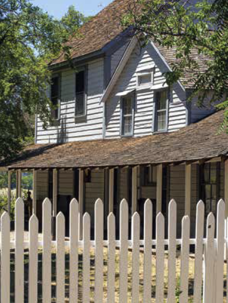
The complex today includes the ranch house and five small outbuildings. The outbuildings include two non-usable privies from the late 1800s; a double garage (ca. 1930); a smokehouse of 20th-century construction; and a shed and corral built in the 1920s and moved to their current location when Highway 53 was built.
The Ranch House
This structure was built in three “wings” during different periods. The central segment dates from the 1860s, the parlor wing from the 1880s, and the Craftsman-style kitchen wing from the 1920s.
The Ranch House exemplifies 19thcentury rural vernacular architecture. Despite substantial alterations over time, the historic integrity of the house is
NATuRAL HISTORY
Climate and Geology
Located in the eastern part of the Coast Ranges in Lake County, the park has the hot, dry summers and cool, wet winters of the Sacramento Valley.
The Clear Lake basin was formed from a combination of tectonic and volcano-induced processes. The formation around the park consists of lake deposits, alluvium, calcareous siltstone, and diatomite.
Geologists believe that faulting from the San Andreas system may increase volcanic activity to the north.
Some of the more prominent landscape features visible from the park are the volcanoes of Mt. Konocti to the northwest and Mt. St. Helena to the south.
RECREATIONAL ACTIvITIES
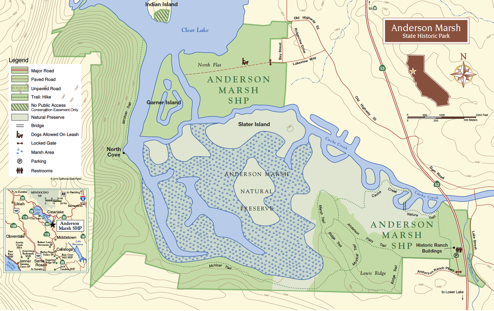
Ridge Trail — This 1-mile trail leads through blue oak woodland.
Cache Creek Nature Trail —This level, 1.1-mile trail goes along Cache Creek, and through grasslands and riparian areas.
Anderson Flats Trail —This easy .8-mile walk goes through grasslands among oaks and spring wildflowers.
Marsh Trail — This half-mile walk through oak woodland has a lovely panoramic view of the marsh.
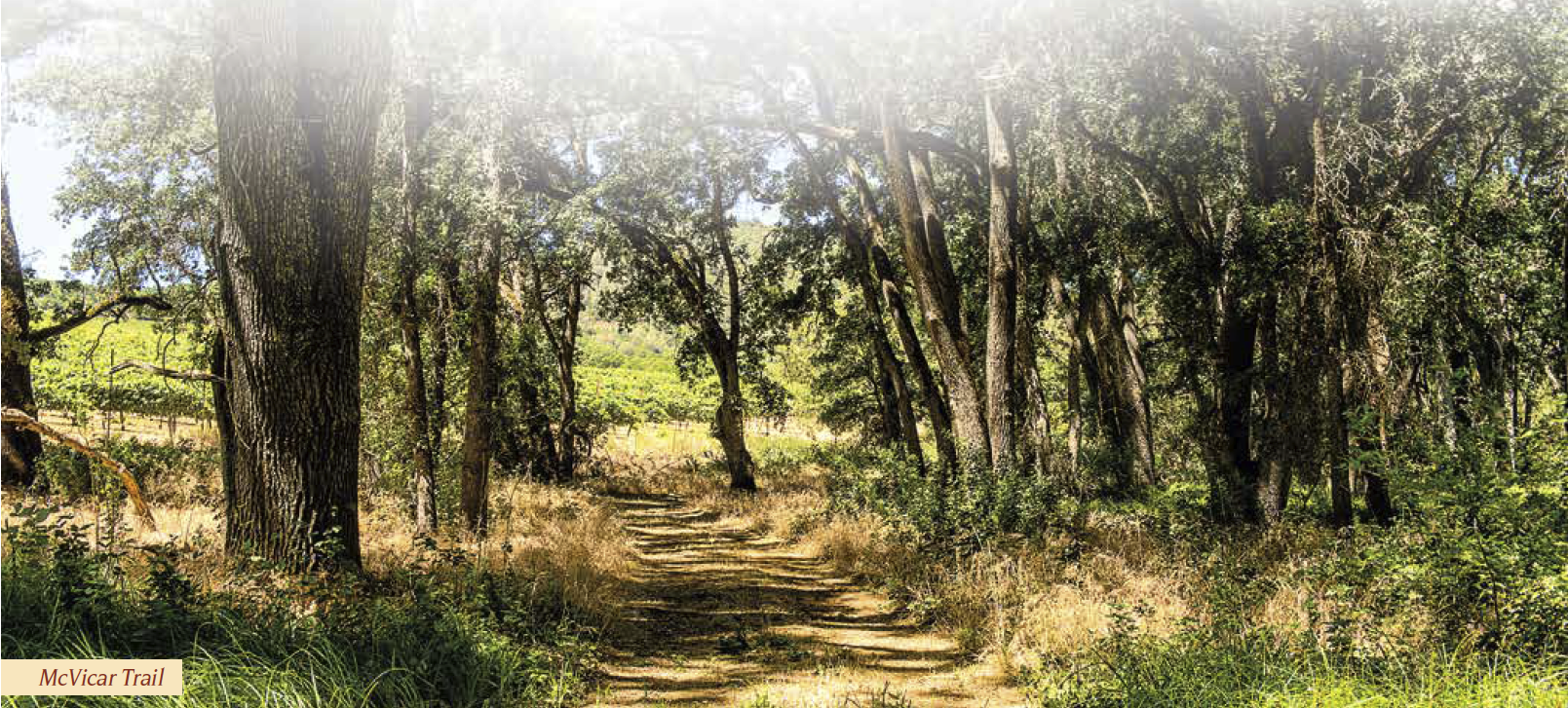
Mcvicar Trail — A 3.5-mile walk through oaks, grasslands, and along the western boundary of the marsh leads to Clear Lake’s shores, across from Indian Island.
Anderson Marsh Park Map
